Walking with Merthyr Valley Ramblers
The Merthyr Valley Group is based in the Heads of the Valleys area of South Wales.
Our Group Walks mainly take place in and around Merthyr Tydfil, in the Brecon Beacons and elsewhere in South East Wales.
Occasionally walks are organised further afield.
All our walks are open to non-members, however, after attending three walks, you will be invited to become a member of the Ramblers Association.
As part of ‘The Ramblers’ we campaign for conservation and improved access to the countryside.
Locally, we help promote and upgrade walk routes, campaign to protect rights of way that are under threat and organise guided walks.
How easy is this walk?
The Ramblers have graded the walks for difficulty as follows:
- Easy Access - walks for everyone, including people with conventional wheelchairs and pushchairs, using easy access paths. Comfortable shoes or trainers can be worn. Assistance may be needed to push wheelchairs on some sections, please contact the group running the walk for details.
- Easy - walks for anyone who does not have a mobility difficulty, a specific health problem or is seriously unfit. Suitable for pushchairs if they can be lifted over occasional obstructions. Comfortable shoes or trainers can be worn.
- Leisurely - walks for reasonably fit people with at least a little country walking experience. May include unsurfaced rural paths. Walking boots and warm, waterproof clothing are recommended.
- Moderate - walks for people with country walking experience and a good level of fitness. May include some steep paths and open country, and may be at a brisk pace. Walking boots and warm, waterproof clothing are essential.
- Strenuous - walks for experienced country walkers with an above average fitness level. May include hills and rough country, and may be at a brisk pace. Walking boots and warm, waterproof clothing are essential. People in doubt about their fitness should contact the organiser or leader in advance.
- Technical - walks for experienced and very fit walkers with additional technical skills. May require scrambling and use of ice axes or crampons. You must contact the organiser or leader in advance for further details.
Important additional advice
- Walk gradings are provided as a general guide only. If you have any doubt about your fitness for a particular walk please contact the organiser or leader in advance.
- Bear in mind the distance of the walk, regional differences in terrain and the possibility of bad weather, which can make a walk more difficult than planned.
- If you're unsure of your fitness level, try a short and easy walk first - it's much better to find a walk a little too slow and easy than to make yourself miserable and exhausted.
- Leaders may refuse to accept participants who in their opinion are inadequately equipped or unfit.
Some of our volunteers use their own local grading systems. If this isn't explained in the walk description, contact the organiser or leader for details.
Click here to download the Ramblers Walks difficulty information.
To help you find the walks that best suit you, The Ramblers use a standard classification system. Classifications are the same for group walks and for Ramblers Routes (though for obvious reasons, some classifications only apply either to walks or to routes).
Classifications don’t always appear - this might be because the people who listed the walk or route didn’t have the right information to hand.
- Suitability - Indication of where a walk or route is suitable for a particular group of people.
- Child friendly - Walk or route with length and terrain suitable for children, though it might not be planned or promoted with children in mind.
- Dog friendly - Walk or route suitable for well-behaved dogs, with no sections where dogs aren't permitted or where it's inadvisable to take them. If a walk, the leader is prepared to accept well behaved dogs though may require them to be kept on a lead.
- No car needed - Walk or route can be reached easily without using a car, either by public transport, using a chartered coach or shared transport, or an urban walk from a central point that's easy to walk to.
- Small groups only - (Routes only) Route is not advised for large groups. A large group in this context is more than 20 walkers. This may be because of environmental impact reasons such as vulnerable wildlife, privacy issues where there is permissive access, or because a large number of obstructions like stiles would slow the group up.
- Pushchair friendly - Walk or route is suitable for conventional pushchairs provided walkers are prepared to lift them over occasional obstructions (some additional walks or routes might be suitable only for all-terrain pushchairs).
- Wheelchair friendly - Walk or route is suitable for users of conventional wheelchairs, though assistance in pushing may be needed by some users in certain places. Some additional walks or routes might be suitable for all-terrain scooters.
- Surroundings - Indication of the surroundings or environment the walk passes through.
- City, townWalk or route in urban surroundings. May be along streets or on traffic-free paths.
- Coast - Walk or route alongside or with a good view of the sea, in urban or rural environment. Beaches, cliffs, seaside promenades.
- Country park - Walk or route through a Country Park - an area of public green space with a significantly rural character.
- Farmland - Walk or route through intensively farmed land, arable and/or livestock. Field paths, farm tracks.
- Hill - Walk or route through hilly country, enough to challenge the walker, but staying below 600 m.
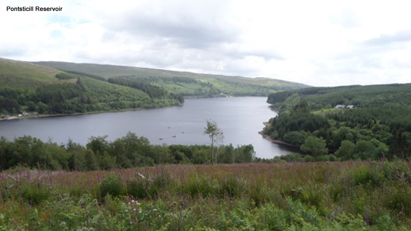
- Lake, pond, reservoir - Walk or route passing or following the shore of significant lakes, lochs, ponds, reservoirs or other bodies of inland water.
- Marsh - Walk or route through marshland or similar wetland environments.
- Moor, heathWalk or route through moorland or heathland.
- Mountain - Walk or route rising above 600 m.
- Open country - Walk or route through general open country - land that isn't wooded or intensively farmed, often giving wide views.
- Park, green space - Walk or route through managed parkland, gardens and similar green spaces, typically urban parks.
- River, canal - Walk or route alongside a river, canal, burn, stream or other inland water channel.
- Village - Walk or route through a rural village. Can also be applied to an urban walk passing through places that retain a traditional village-like appearance.
- Woodland - Walk or route through woodland of all kinds: woods, forests, plantations, in both urban and rural settings.
- Theme - Indication if the route or walk has a particular theme, due to the places visited, or what the route developer or walk leader chooses to highlight.
- Adventure - Adventurous walk or route for example exploring wild land or remote countryside or with a link to other adventurous activities.
- Architecture - Walk or route featuring interesting architecture of any period.
- Arts, culture - Walk or route with an art or culture connection, for example film locations, novels/writers, or linked to an art or cultural activity such as a local arts festival.
- Family fun - Walk or route with features/activities of particular interest to children, or promoted to children, as well as being through terrain suitable for them.
- Garden - Walk or route visiting gardens or similar sites.
- History, heritage - Walk or route with a focus on sites of historical or heritage interest: historic buildings, sites of historic events etc.
- Long distance path - Walk or route along a section of a longer recognised path such as a national trail.
- Treasure hunt, geocaching - Walk or route involving a treasure hunt, geocaching or similar activity.
- Wildlife, nature - Walk or route with a focus on sites of wildlife interest, rare species, wildflower displays, migrating birds etc.
- Special status - Indication if the walk or route includes sites with a specific designation, or a Ramblers success.
- Area of Outstanding Natural Beauty, National Scenic Area, Heritage Coast - Walk or route visiting a site within an officially designated Area of Outstanding Natural Beauty or Heritage Coast (England and Wales) or National Scenic Area (Scotland).
- Community Forest, Regional Park - Walk or route visiting a site within a Community Forest, the National Forest or a Regional Park.
- Conservation Area - Walk or route visiting a Conservation Area as recognised by the national heritage body and the local council.
- Historic park / garden - Walk or route visiting a Historic Park or Garden as recognised by the national heritage body.
- National Park - Walk or route visiting a recognised National Park.
- National Trail, Scotland's Great Trail - Walk or route using a section of an official National Trail, Scotland's Great Trail or the England or Wales Coast Paths.
- Nature designation (SSSIs, Nature Reserves etc) - Walk or route visiting a site with an official national or international nature conservation designation. These include: Biosphere reserve, Local Nature Reserve (LNR), Marine Conservation Zone (MCZ), Marine Protected Area (MPA), National Nature Reserve (NNR), Ramsar site, Site of Community Importance (SCI), Special Area of Conservation (SAC), special Protected Area (SPA), Site of Special Scientific Interest (SSSI).
- Open access land - Walk or route visiting open access land designated under the Countryside and Rights of Way Act 2000 in England and Wales (Mountain, moor, heath, down, registered common land and other voluntarily designated land).
- Ramblers success - Walk or route where a section has been opened up or improved thanks to Ramblers campaigning or practical work.
- World Heritage Site - Walk or route visiting a World Heritage Site as designated by UNESCO.
- Facilities - Indication if particular facilities (toilets, refreshments, baby changing etc) are available at key points of the walk or route.
- Baby changing facilities - Baby changing facilities are available at the starting point and ideally the finishing point of the walk/route.
- Bed and breakfast - Bed and breakfast accommodation close to the starting point and/or finishing point of the walk or route.
- Camping, bothy - Recognised camping site, camping barn or bothy close to the starting point and/or finishing point of the walk or route.
- Disabled toilet - Disabled toilet at the starting point and finishing point of the walk or route, and ideally along the way on longer routes.
- Hostel - Hostel accommodation close to the starting point and/or end of the finishing point walk or route (this includes both ‘official’ and independent hostels).
- Parking - Car park available at the starting point of the walk or route.
- Refreshments - Refreshments available at both the starting point or the finishing point of the walk or route, and along the way on longer walks/routes. May be a cafe, pub, kiosk or other facility.
- Shelter - Shelter is available at the starting point of the walk or route.
- Toilet - Public toilets are available at the starting point and finishing point of the walk or route, and ideally along the way on longer routes.
Click here to download the Ramblers Walks classifications information.
IM your name, car colour and the last three letters of it's registration to the walk leader or any Merthyr Valley Ramblers member and you will be greeted personally on the walk and introduced to everyone.
Text Alan Hancox on 07901 576703 and you can follow him from Merthyr Tydfil.
Please wear strong shoes or walking boots. The weather can change very quickly, particularly on the hills, so bring a waterproof and wear warm clothing.
For your own safety, walk leaders may refuse to accept inadequately clad walkers. On all walks you need to bring a packed lunch and drink.
Please check the programme before each walk for the time and place of departure.
Ordnance Survey Map grid reference are given in each walk description. For further details please contact the Walk Leader.
When weather conditions are particularly bad, the walk may be altered or cancelled at the walk leader's discretion. In the event of bad weather, walkers should contact the walk leader to enquire as to whether or not the walk will take place.
If you bring a dog, it should be on a lead and kept under control. You must comply with our Group Dogs Protocol at all times.
Summary of the Countryside Code:
- Respect everyone
- be considerate to those living in, working in and enjoying the countryside
- leave gates and property as you find them
- do not block access to gateways or driveways when parking
- be nice, say hello, share the space
- follow local signs and keep to marked paths unless wider access is available