
The Ramblers
Members of the Ramblers enjoy:
- A library jam-packed with thousands of tried-and-test routes. Online and Exclusive to you on the app
- Unlimited free access to 50,000 Ramblers group walks, guided by a walk leader along safe, accessible routes
- Savings on walking gear, gadets and more with exlusive discounts from Cotswold Outdoor and our partners
- A welcome pack teeming with top tips plus our quarterly Walk magazine
- What's more, you'll be a driving force behind increasing access to green spaces, opening up more places to walk and boosting Britain's well-being one step at a time, just by joining the Ramblers
Members Notice
Merthyr Ramblers Social Evening
Join us every first Monday of each month at 6pm in Merthyr Wetherspoons (Y Dic Penderyn) for our monthly social evening. Everyone welcome - come and meet the Merthyr Valley Ramblers. Good company and a quiz to boot. Downstairs in the old library.
Please tag your photographs in Instagram with the Merthyr Valley Ramblers hashtag: #merthyrvalleyramblers
Click here to view Our walks Journey so far through 2026
Click here to view booking walks for Merthyr Valley ramblers
Walks coming soon …
click on walk date to view walk information
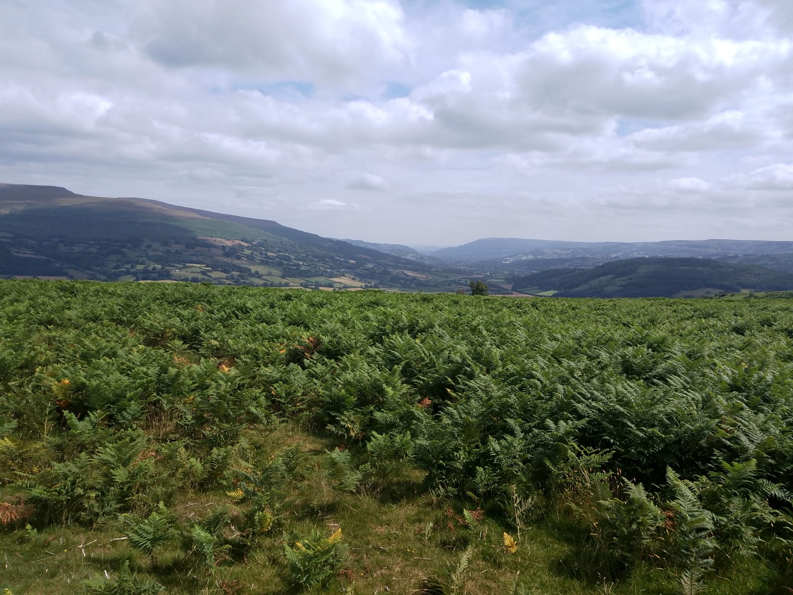
Bwlch Moorland Ramble
Date: Saturday, 6 June 2026
Walk type: Linear & return
Start time: 10:00 am
Estimated finish time: 2:30 pm
Distance: 7 miles / 11.3 km
Walk difficulty: Moderate
Booking is not essential
From the car park which is situated at the end of Tremynfa road Bwlch. Sign posted from the A40 Bwlch. A gradual easy climb up a stoney gulley on to the path across the Moorland, no stiles, no gates, no cows, just sheep. Stunning views over the Black Mountains and area. Linear walk, when lunch will be taken and we will return the way we came with a totally different aspect of the surrounding mountain view.
Start Place: A pull in on the side of the road, situated along Tremynfa road.
Grid Ref: SO 16050 22450
What3Words: perfumed.shatters.proposals
Walk classification:
Suitability: Dog friendly,
Surroundings: Farmland, Moore, Heath.
Facilities: Parking.
Joint walk with Morton Ramblers
Date: Saturday, 6 June 2026
Walk type: Circular
Start time: 10:00 am
Estimated finish time: 4 pm
Distance: 8.5 miles / 13.7 km
Walk difficulty: Moderate
Booking is necassary
Walk description: Starting in the centre of town we cross the A44 and head via Rushock to join the Mortimer Trail and cross the Offa’s Dyke. Down the hill through woods brings us to the little village of Knill where we might find a dragon. We will then join the Offa’s Dyke Path with another section of the ancient monument before heading back to Kington. We will hopefully end the walk with refreshments in Kington
Start Place: Meet by bench opposite the primary school next to the Mill Street pay and display car park. There may be free parking available on the road.
Grid Ref: SO 29550 56550
GPS: 52.20266, -3.03227
What3Words: tomato.bidder.scope
Walk classification:
Surroundings: Village, Offa's Dyke.
Theme: Woodland.
Special Status: Ancient monument.
Facilities: Parking, Pay and display.
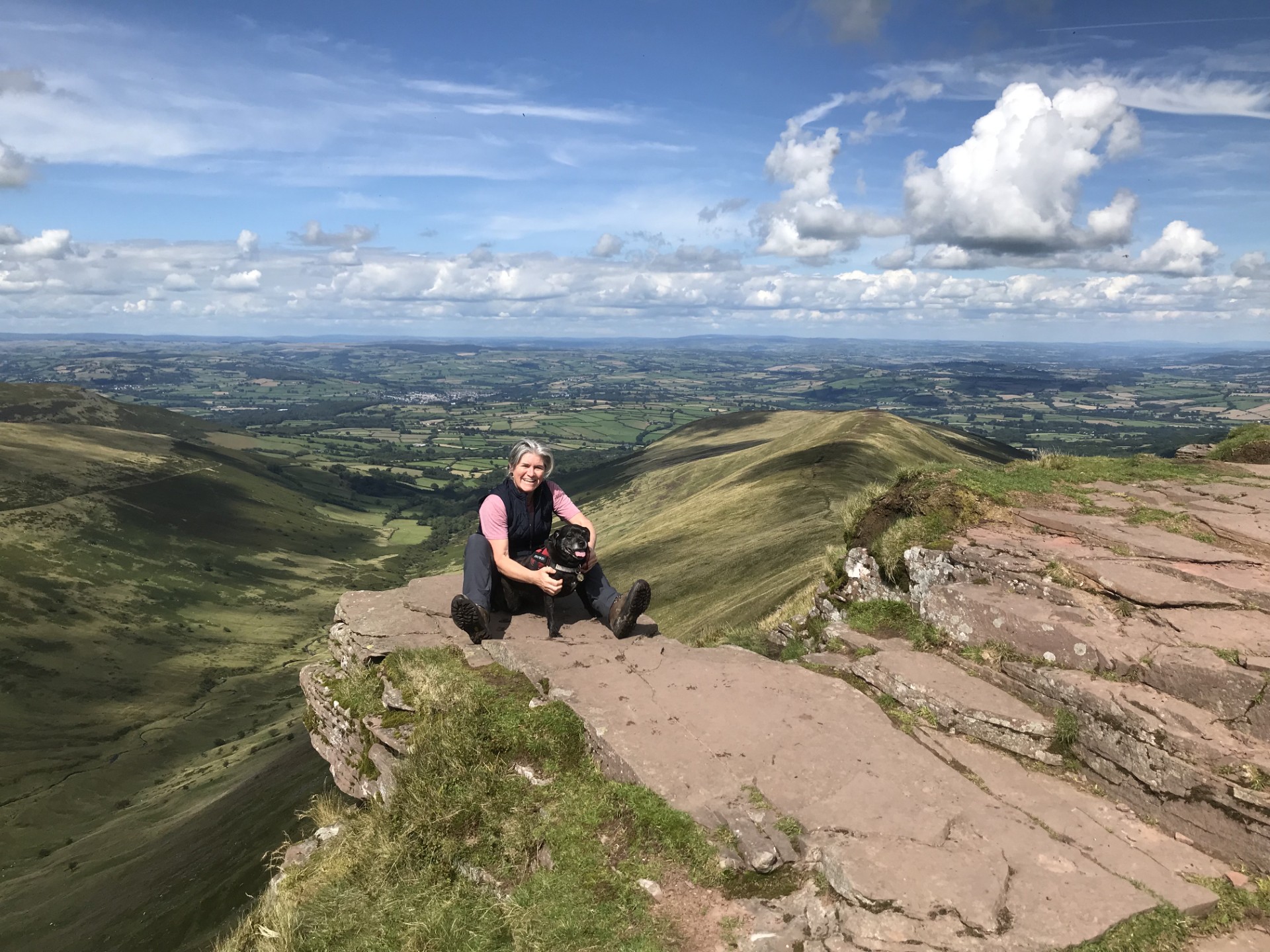
Fan y Big
Date: Saturday, 13 June 2026
Walk type: Circular
Start time: 9.30 am
Estimated finish time: 3.30 pm
Distance: 9 miles / 14.5 km
Walk difficulty: Strenuous
Booking is Required
Walk description: We leave from the parking lot in Taf Fechan Forest and begin our climb along the beacons way to the top of Craig y Fan Ddu where we stop for coffee. We then stay on the top of the ridge for approximately 3 miles before we climb to the top of Fan y Big at an elevation of 717 meters. After enjoying a well-deserved lunch we descend to the gap road and head back to the parking lot. Please note the early start time of 9.30 due to the car park filling up
Walk classification(s):
Suitability: Dog friendly (on leads).
Surroundings: Moor, mountain, resovior.
Facilities: Parking.
To be announced …
Date: Saturday, 20 June 2026
Walk leader: Jenny Edwards
Walk Title: A Stroll Over the Foel
Distance: 8 miles
Grade: Moderate
Date: Saturday, 27 June 2026
Walk leader: Caroline Kelly
Walk Title: Mynydd Llangorse Circular
Distance: 8.5 miles
Grade: Moderate
Date: Saturday, 4 July 2026
Walk leader: Robert Jewels
Walk Title: Park Slip, Aberkenfig
Distance: 9 miles
Grade: Moderate
Date: Saturday, 11 July 2026
Walk leader: TBA
Walk Title: TBA
Distance: TBA
Grade: TBA